Perinthalmanna
Perinthalmanna | |
|---|---|
Municipality | |
| Perintalmanna | |
 Night view of Perinthalmanna Municipal town | |
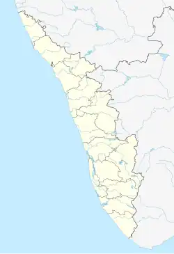 Perinthalmanna Location in Kerala, India  Perinthalmanna Perinthalmanna (India) | |
| Coordinates: 10°58′36″N 76°13′37″E / 10.9765415°N 76.2269231°E | |
| Country | |
| State | Kerala |
| District | Malappuram |
| Taluk | Perinthalmanna |
| Revenue villages | Perintalmanna Pathaikkara |
| Government | |
| • Type | Second Grade Municipality |
| • Body | Perinthalmanna Municipality |
| • Chairman | P. Shaji (CPI-M) |
| • Vice Chairperson | Naseera. A |
| • M.L.A | Najeeb Kanthapuram (UDF) |
| Area | |
• Total | 34.41 km2 (13.29 sq mi) |
| Population (2011)[1] | |
• Total | 49,723 |
| • Density | 1,445/km2 (3,743/sq mi) |
| Languages | |
| • Official | Malayalam, English |
| Time zone | UTC+5:30 (IST) |
| PIN | 679322 |
| Telephone code | 04933 |
| Vehicle registration | KL-53 |
| State Assembly Constituency | Perinthalmanna |
| Lok Sabha Constituency | Malappuram |
| Website | perinthalmannamunicipality |
Perinthalmanna is a major town and municipality in Malappuram district, Kerala, India. It serves as the administrative centre for the Perinthalmanna taluk, as well as a revenue division, a community development block, and a police sub-division bearing the same name.[2] It was formerly the headquarters of the Kingdom of Valluvanad. The town is located 23 kilometres (14 mi) southwest of Malappuram at the centre of the Kozhikode–Palakkad National Highway 966.[3]
It is one of the major commercial centers in the Malappuram district but is not a part of the Malappuram metropolitan area.
The city is home to several medical institutions and one of the three branches of Aligarh Muslim University in India.
History
Perinthalmanna was the capital of the Valluvanad Swaroopam dynasty. Valluvanad was ruled by a Samanthan Nair clan known as Vellodis, similar to the Eradis of neighbouring Eranad and the Nedungadis of Nedunganad. The rulers of Valluvanad were known by the title Valluvakonathiri or Vellattiri.
According to local legends, the last Cheraman Perumal ruler gave a vast expanse of land in South Malabar to one of the Valluvakonathiri before going on pilgrimage to Mecca. Valluvanad was famous for the Mamankam festivals (held once every 12 years) and chronic wars against the Zamorin of Calicut.
During the last decades of the eighteenth century, the region came under the control of the vast Kingdom of Mysore, and was the headquarters of the Kingdom of Valluvanad. Perinthalmanna, along with the towns of Malappuram, Manjeri, and Tirurangadi, was one of the main centres of the Malabar Rebellion of 1921.[4] Now it is one of the important commercial centre in Malappuram district.
Perinthalmanna became a Grama Panchayat in 1933 under the Malabar District board. The town was later upgraded to a municipality on 10 February 1990.[5] As of the 2011 India census, Perinthalmanna had a population of 49,723 spread over an area of 34 km2 (13 sq mi).[1][6] Perinthalmanna serves as the headquarters of one of the two revenue divisions in Malappuram district, having jurisdiction over Perinthalmanna, Eranad, and Nilambur taluks. Perinthalmanna is also as the headquarters of Perinthalmanna Block Panchayat and Revenue Divisional Office and Sub Divisional Police Office.[7][8][9]
Geography
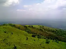
The Thuthapuzha, a tributary of the Bharathappuzha (Ponnani River), which is also the longest river of Kerala, passes through Perinthalmanna.[10] The Western Ghats mountain range begins east of Perinthalmanna.[10] Kodikuthimala hillstation is located in the Thazhekode village of Perinthalmanna Taluk, which also shares its boundary with the municipality of Perinthalmanna.[10] Melattur village of Perinthalmanna Taluk is a part of Nilgiri Biosphere Reserve.[10]
Angadipuram Laterite is a notified National Geo-heritage Monument located about two kilometres (1.2 mi) west of the Perinthalmanna town centre. [11][12][13]
Gulmohar flowering trees are widely seen in the Perinthalmanna area.[14]
Demographics
- Islam (58.5%)
- Hinduism (38.4%)
- Christianity (2.97%)
- Other (0.11%)
The population of Perinthalmanna was 49,723 as of the 2011 census.[1] Males constituted 47.3% and females 52.7%.[1] Malayalam is the most spoken language in the town. Perinthalmanna has been a multi-ethnic and multi-religious town since the early medieval period. Muslims form the largest religious group, followed by Hindus and Christians.[15] The municipality of Perinthalmanna has an average literacy rate of 95.3%, which is higher than the state average of 94.0%.[1]
Etymology
The name Perinthalmanna is traditionally associated with the cultural practices of the region. Historical accounts suggest that during the period when Kakkoothu Nair, the commander of the Valluvakonathiri’s army, served as president, annual athletic performances were held in the area. These events, known as Perum Thallu (a traditional martial or athletic contest), were conducted at a site located to the east of present-day Angadipuram.[16][17]
Perum (പെരും): Meaning “great” or “grand.”
Thallu (തല്ല്): Meaning “fight,” “combat,” or “contest.”
Manna (മണ്ണ): Meaning "place", "location".
Over time, the place associated with Perum Thallu came to be known as Perinthalmanna.
Civic administration
| Attribute | Details |
|---|---|
| Established | 10 February 1990 |
| Area | 34.41 km² |
| Population (2011) | 49,723 |
| Number of Wards | 37 |
| Chairperson | P. Shaji (CPIM) |
| Vice Chairperson | Naseera. A (CPIM) |
The town is administered by the Perinthalmanna Municipality, headed by a chairperson. For administrative purposes, the municipality is divided into 37 wards,[18] from each of which members of the municipal council are elected for five years. As of 2011 India census, Perinthalmanna Municipal Region had a population of 49,723 spreading an area of 34 sq.km. Following the 2025 ward delimitation, Perinthalmanna Municipality now comprises 37 wards, increased from 34.[19] These wards are:[20]
- Cheerattamanna
- Manathumangalam
- Kakkooth
- Mundathappadi
- Valiyangadi
- Kulirmala
- Chembankunnu
- Kunnumpuram
- Aalakunnu
- Ponniyakurussi
- Idukkumukham
- Manazhi Stand
- Panchama
- Kuttippara
- Kovilakampadi
- Pathaikkara U.P School
- Manappadi
- P.T.M College
- Thanneerpanthal
- Olinkara
- Aanathaanam
- Kizhakkekara
- Thekkekara
- Padinjarekkara
- Valayammoochi
- Aasharikkara
- Marukaraparamba
- Kunnappally South
- Kollakode
- Vattapara
- Thekkinkode
- Kavungaparamba
- J.N Road Central
- Thottakkara
- Puthoor
- Muttungal
- Lemon Valley
Perinthalmanna Municipality election 2020
| S.No.[21] | Party name | Party symbol | Number of councillors |
|---|---|---|---|
| 01 | LDF | 17 | |
| 02 | UDF | 09 | |
| 03 | Independents |  | 08 |
Law and order
The municipality comes under the jurisdiction of the Perinthalmanna Police Station, which was formed on 1 September 1988.[22] The station has the jurisdiction over the revenue villages of Perinthalmanna, Pathaikara, Angadipuram, Elamkulam, Aliparamba, Anamangad, Arakkuparamba, Thazhekode, and parts of Pulamantol and Valambur.[22]
The border police stations are headquartered at Kolathur, Mankada, Melattur, Koppam, Nattukal and Cherpulassery.[22]
Perinthalmanna is also the headquarters for one of the six subdivisions of Malappuram District Police.[23] The police stations at Perinthalmanna, Kolathur, Mankada, Melattur, Pandikkad, and Karuvarakundu come under the jurisdiction of the Perinthalmanna subdivision.[23] Perinthalmanna Traffic Enforcement Unit also comes under the subdivision.[23]
Courts
The court complex at Perinthalmanna has the following courts:[24]
- Munsiff Magistrate Court, Perinthalmanna
- Judicial First Class Magistrate Court II, Perinthalmanna
- Fast Track Special Court (POCSO)
Appeals from its judgments go to higher courts in Manjeri, which is the district headquarters of the judiciary.
Munsiff Magistrate Court, Perinthalmanna
The Munsiff Magistrate Court, Perinthalmanna functions as a lower court of both civil and criminal jurisdiction. In its civil capacity, it functions as a Munsiff Court, dealing with civil cases and exercising territorial jurisdiction over Perinthalmanna taluk. In its criminal capacity, it operates as a First Class Magistrate Court, dealing with criminal cases and exercising jurisdiction over the Perinthalmanna and Kolathur police station limits and Perinthalmanna Excise Range Office limits.
Judicial First Class Magistrate Court II, Perinthalmanna
This Magistrate Court has jurisdiction over the police station limits of Pandikkad, Wandoor, Mankada, and Melattur.
Fast Track Special Court, Perinthalmanna
The Fast Track Special Court (POCSO), Perinthalmanna functions within the court complex to exclusively handle cases registered under the Protection of Children from Sexual Offences (POCSO) Act, 2012. It is presided by a special judge.
Elected representatives
Perinthalmanna assembly constituency consists Perinthalmanna Municipality and surrounding panchayats of Melattur, Vettathoor, Thazhekkode, Aliparamba, Elamkulam and Pulamanthole. It is part of the Malappuram Lok Sabha constituency. The current MLA, Najeeb Kanthapuram, and MP, Abdussamad Samadani, are from the Indian Union Muslim League (IUML), respectively.[25]
| MLA of Perinthalmanna | |
|---|---|
 Incumbent since 2021Najeeb Kanthapuram (IUML) | |
| Member of | Kerala Legislative Assembly |
| Precursor | Manjalamkuzhi Ali |
| First holder | P. Govindan Nambiar |
| Member of Parliament (Lok Sabha) | |
|---|---|
 Incumbent since 2021M. P. Abdussamad Samadani (IUML) | |
| Abbreviation | MP |
| Member of | Parliament of India (Loksabha) |
Health care
Perinthalmanna is widely regarded as a major health care hub in Kerala, often referred to as the “hospital city” of Malabar due to the high concentration of multi-speciality hospitals, super-speciality centres, and clinics located in and around the town. Patients from across Malappuram district and neighbouring regions such as Palakkad, Thrissur, and Kozhikode frequently seek medical treatment here.[26]
The following is the list of hospitals in Perinthalmanna;
- Government District Hospital, Perinthalmanna
- Moulana Hospital, Perinthalmanna
- KIMS Alshifa Hospital, Peinthalmanna
- EMS Memorial Co-operative Hospital, Perinthalmanna
- MES Medical College Hospital, Perinthalmanna
- Perinthalmanna Nursing Home Hospital
- Amina Hospital, Perinthalmanna.
- Al Salama Eye Hospital, Perinthalmanna
- Government Ayurveda Hospital, Peinthalmanna
- Ramdas Hospital, Perinthalmanna
Nearby places
Neighbourhoods
Source:[27]
- Valiyangadi
- Cheerattamanna
- Manathumangalam
- Kakkooth
- Ponniakurussi
- Pathaikkara
- Jubilee
- Kunnappally
- Eravimangalam
- Olinkara
Towns and villages
- Angadipuram (2.8 km)
- Chungam, Pattikkad (4.7 km)
- Kolathur (12 KM)
- Anamangad (7.7 km)
- Elamkulam (9.2 km)
- Valambur (8.4 km)
- Thazhekkode (10 km)
- Vettathur (12 km)
- Melattur (12 km)
- Keezhattur (11 km)
- Pulamanthole (12 km)
- Aliparamba (15 km)
Notable people
- Manjalamkuzhi Ali – the former MLA from the constituency
- Vinay Govind – film director
- Paloli Mohammed Kutty – politician and social worker
- K. P. A. Majeed – politician
- Vazhenkada Kunchu Nair
- E. M. S. Namboodiripad, first Chief Minister of Kerala
- Poonthanam Nambudiri – author of the poem Njanappana
- Mersheena Neenu – actress
- Neralattu Rama Poduval
- V. Sasikumar – politician and union leader
- Nalakath Soopy – MLA for 26 years from 1980 to 2006 and former Minister for Education
- P. Sreeramakrishnan – politician
- Vazhenkada Vijayan – retired principal of Kerala Kalamandalam
Perinthalmanna Block
Perinthalmanna Block Panchayat is the rural local body responsible for the block-level administration of the following Gram panchayats:[2]
- Aliparamba
- Angadipuram
- Elamkulam
- Keezhattur
- Melattur
- Pulamantol
- Thazhekode
- Vettathur
Perinthalmanna Block Panchayat is divided into 17 divisions, with each member elected from a division. The divisions are as follows:[28]
| Ward no. | Name | Ward no. | Name |
|---|---|---|---|
| 1 | Nenmini | 10 | Kunnakkavu |
| 2 | Chemmaniyode | 11 | Elamkulam |
| 3 | Melattur | 12 | Pulamanthole |
| 4 | Karyavattoom | 13 | Kuruvambalam |
| 5 | Vettathoor | 14 | Pariyapuram |
| 6 | Arakkuparamba | 15 | Thirurkkad |
| 7 | Thazhekkode | 16 | Angadippuram |
| 8 | Aliparamba | 17 | Pattikkad |
| 9 | Anamangadu |
Transportation
Air
The nearest airport to Perintalmanna is Karipur Airport, 45 km (28 mi) from Kondotty.
Rail

The Nilambur–Shoranur line has three stations near Perinthalmanna: a major station at Angadipuram, which is located 2.5 km (1.6 mi) west of the town, and two minor stations at Pattikkad and Cherukara.
Trains are available from here to Nilambur, Shornur, Palakkad, Kottayam, and Kochuveli.
Road

Perinthalmanna is situated at the centre of Kozhikode–Malappuram–Perinthalmanna-Palakkad National Highway 966.[5] Additional notable roads in Perinthalmanna include:
- Pattambi Road, Cherpulassery Road, Valanchery Road, Nilambur Road, Kozhikode Road, Palakkad Road, and Ooty Road[5]
- Shornur–Perinthalmanna State Highway 23 – ends by joining National Highway 966 at Perinthalmanna[5]
- Perumbilavu–Nilambur State Highway 39
- State Highway 53 – connects Palakkad to Perinthalmanna via Cherpulassery[5]
- Valanchery–Nilambur State Highway 73[5]
The town is facilitated by a KSRTC Sub Depot, and three private bus stands.[5]
See also
- Angadipuram Laterite
- Education in Perinthalmanna
- Kingdom of Valluvanad
- Nilambur - Shoranur Railway Line
- Pacheeripara
- Perinthalmanna (State Assembly constituency)
- Perinthalmanna Taluk
- Thirumandhamkunnu Temple
References
- 1 2 3 4 5 6 "Malappuram census handbook" (PDF). censusindia.gov.in.
- 1 2 "Perinthalmanna Block". lsgkerala.gov.in.
- ↑ S. Anil Radhakrishnan (24 March 2018). "New Roads, New Vistas". The Hindu.
- ↑ Sreedhara Menon, A. (2007). A Survey of Kerala History (2007 ed.). Kottayam: DC Books. ISBN 9788126415786.
- 1 2 3 4 5 6 7 "Perinthalmanna - About city". Kudumbasree. Retrieved 11 December 2020.
- ↑ "Kudumbashree | About ULBs - Perinthalmanna Municipality". www.kudumbashree.org. Retrieved 5 May 2023.
- ↑ "Revenue Divisional Office, Perinthalmanna | Welcome to Malappuram | India". Retrieved 5 May 2023.
- ↑ "Official Website of Malappuram - Perinthalmanna Sub Division". malappuram.keralapolice.gov.in. Retrieved 5 May 2023.
- ↑ "Block Panchayaths | CRD". rdd.lsgkerala.gov.in. Retrieved 5 May 2023.
- 1 2 3 4 Directorate of Census Operations, Kerala. District Census Handbook, Malappuram (PDF). Thiruvananthapuram: Directorate of Census Operations, Kerala.
- ↑ "National Geological Monument, from Geological Survey of India website". Archived from the original on 12 July 2017. Retrieved 23 May 2017.
- ↑ Geo-Heritage Sites, Minister of Mines Press release, 09-March-2016
- ↑ national geo-heritage of India, INTACH
- ↑ Our Currespondent (21 May 2020). "Gulmohar flowers give a different hue to Melattur railway station". Onmanorama. Manorama Online. Retrieved 30 April 2021.
- 1 2 "Religion – Kerala, Districts and Sub-districts". Census of India 2011. Office of the Registrar General.
- ↑ "Perinthalmanna - History, Details, Route Map and Location". www.valluvanad.com. Retrieved 3 September 2025.
- ↑ "HISTORICAL GEOGRAPHY OF VALLUVANAD -" (PDF).
- ↑ "Perinthalmanna municipality". lsgkerala. Retrieved 30 November 2020.
- ↑ Ward list of Perinthalmanna- State Election Commission, Kerala
- ↑ "Wards of Perinthalmanna". sec.kerala.gov.in.
- ↑ "LOCAL BODY ELECTIONS KERALA - TREND 2020". Retrieved 16 December 2020.
- 1 2 3 "Perinthalmanna PS". Kerala police. Retrieved 30 November 2020.
- 1 2 3 "Perinthalmanna Subdivision". Kerala police.
- ↑ "History | DISTRICT COURT MANJERI | India". malappuram.dcourts.gov.in. Archived from the original on 19 April 2025. Retrieved 3 September 2025.
- ↑ "Members - Kerala Legislature". www.niyamasabha.org. Retrieved 20 December 2023.
- ↑ "Malappuram-Public Hospitals – sha". sha.kerala.gov.in. Retrieved 3 September 2025.
- ↑ "Revenue Portal". village.kerala.gov.in. Retrieved 13 December 2023.
- ↑ "Perinthalmanna Block Panchayat | Local Self Government Department". lsgkerala.gov.in. Retrieved 21 December 2023.
External links
Articles Related to Perinthalmanna | |||||||||||||||||||||||||||||||||||||||||||||||||
|---|---|---|---|---|---|---|---|---|---|---|---|---|---|---|---|---|---|---|---|---|---|---|---|---|---|---|---|---|---|---|---|---|---|---|---|---|---|---|---|---|---|---|---|---|---|---|---|---|---|
| |||||||||||||||||||||||||||||||||||||||||||||||||